About the TREESPEC project
Forests provide crucial ecosystem services such as carbon sequestration, water regulation, timber supply, soil stabilization, and biodiversity enhancement. However, forests with greater tree species diversity offer more benefits and are more resistant to pests. Large-scale species mapping has been hindered by difficulties in obtaining predictive parameters that accurately reflect the spectral, structural, and phenological properties of forests. The “Treespec” project seeks to address the challenge of mapping tree species composition and proportions at a fine spatial resolution, filling a significant gap in remote sensing research.
The project is funded by the Swedish National Space Agency (2023 - 2026) and is tasked with investigating methods to improve large-scale tree species mapping using advanced satellite remote sensing and machine learning techniques. The focus of Treespec is southern Sweden where most of the country’s diverse forests occur and using data from the Sentinel-1 synthetic aperture radar and Sentinel-2 multispectral sensors, the project will generate valuable data products that contribute to understanding species dynamics and their role in ecosystem functions.
The project’s findings will help forest owners, researchers, and policymakers make informed decisions to address climate change and promote biodiversity conservation. All data produced by Treespec will be provided freely to the public.
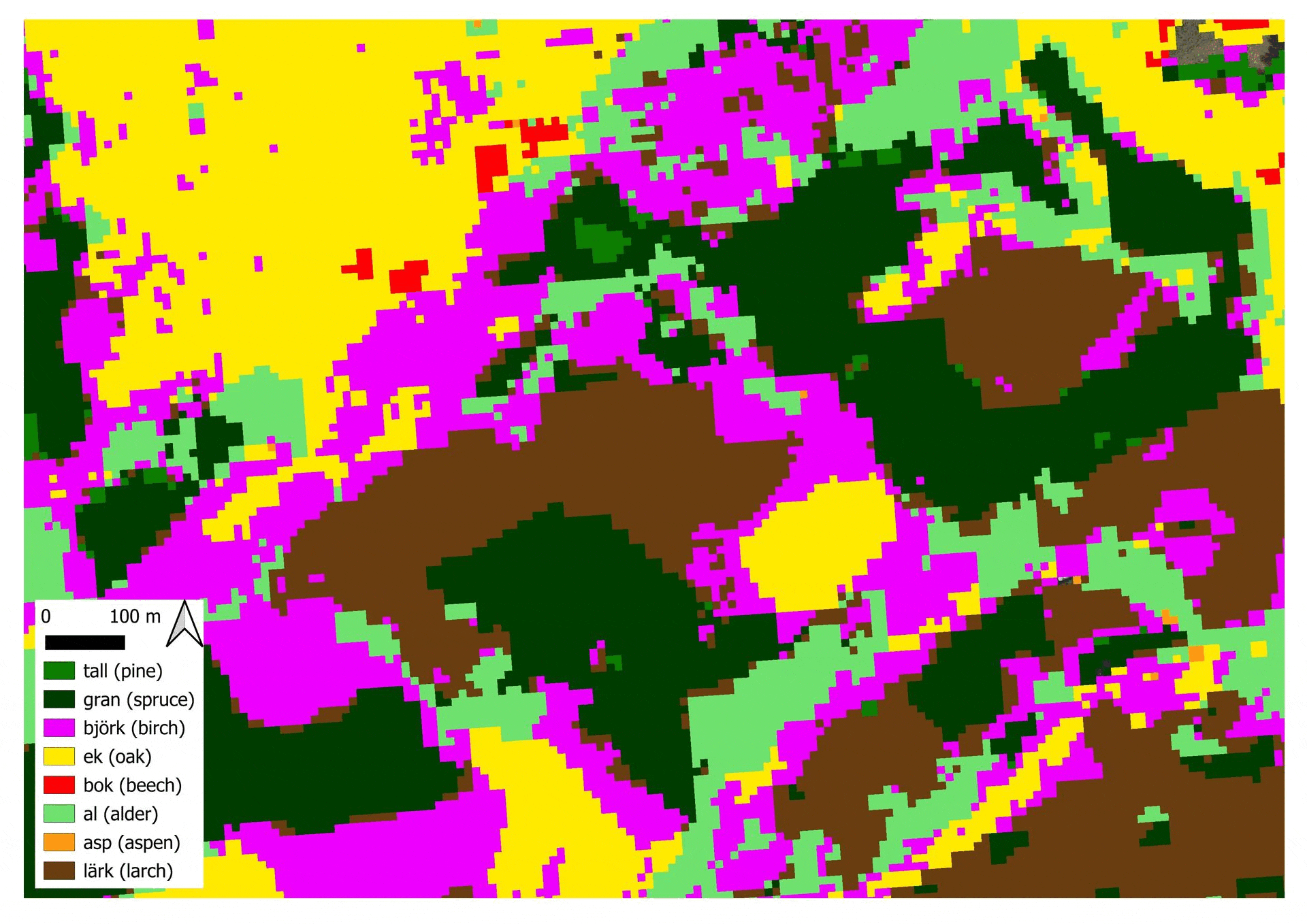
Animation of preliminary data that was produced for a forested region in the Swedish province of Scania.